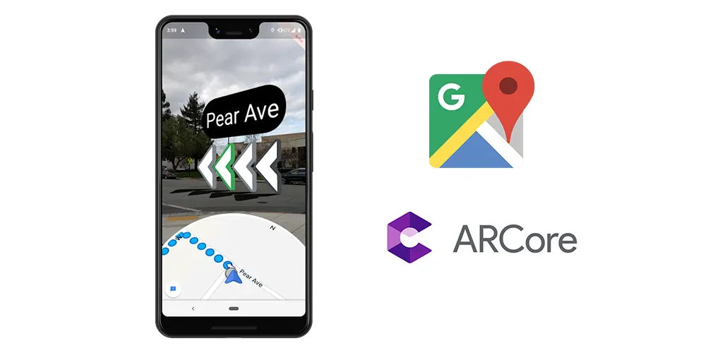
Google recently announced that their flagship Pixel phones would be getting a new form of navigation that uses augmented reality to help users with walking directions in the Google Maps app. Google have yet to announce whether the feature will be coming to Google Maps on other phones that support AR, but as an owner of a Pixel 3XL, I was keen to try the feature out as soon as it dropped.
The feature is simply an additional option when you’re using the phone in navigation mode for walking directions. When activated, you hold the phone up to your surroundings, and it will display directions overlaid onto the visuals from your phone’s camera.
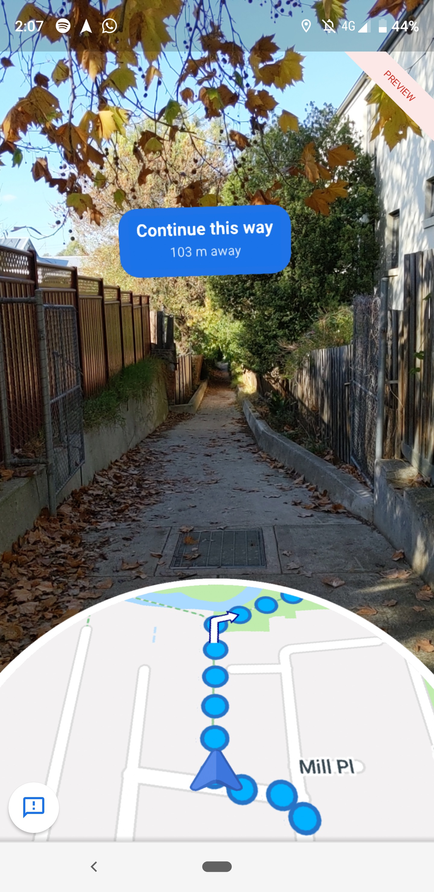
Upon starting the service, there’s a small period where the phone has to identify its surroundings before the directions are displayed on top of the camera, which I found ranged quite drastically in duration depending on where I was. If I was on a main street, or an area with lots of clear and defined structures, it would only take a second and I would barely have to move the phone. On the occasions where I strayed from a main street, or I was in a more grassy, barren area, the app struggled to detect where I was until I turned around and showed it more of my surroundings.
There was one occasion, in the north of Melbourne along the Merri Creek, where the phone couldn’t pick up the walking path that I was on, as there were no significant structures around me. The path was part of the navigation route, but I later realized it wasn’t included in Google Street View, which Google uses to locate you for the AR directions. Although a minor issue, it seems odd the directions had taken me to a path that it should have known it wouldn’t have been able to identify in AR, by virtue of it not being included in Street View.
I also had mixed results when using the service at night. It does warn you that you can’t use it in the dark, but I found that at dusk I still had some luck with the camera locating my position. It seems that as long as it’s not completely pitch black outside yet, the algorithm might still be able to pick up where you are.
One of the main drawpoints of the feature is that by using the camera to identify buildings and landmarks, the directions are hypothetically more consistently correct. This is because it’s not relying on GPS and a phone’s internal sensors to determine position and orientation, both of which can be affected in high-density areas by objects like cars and magnets, among other things.
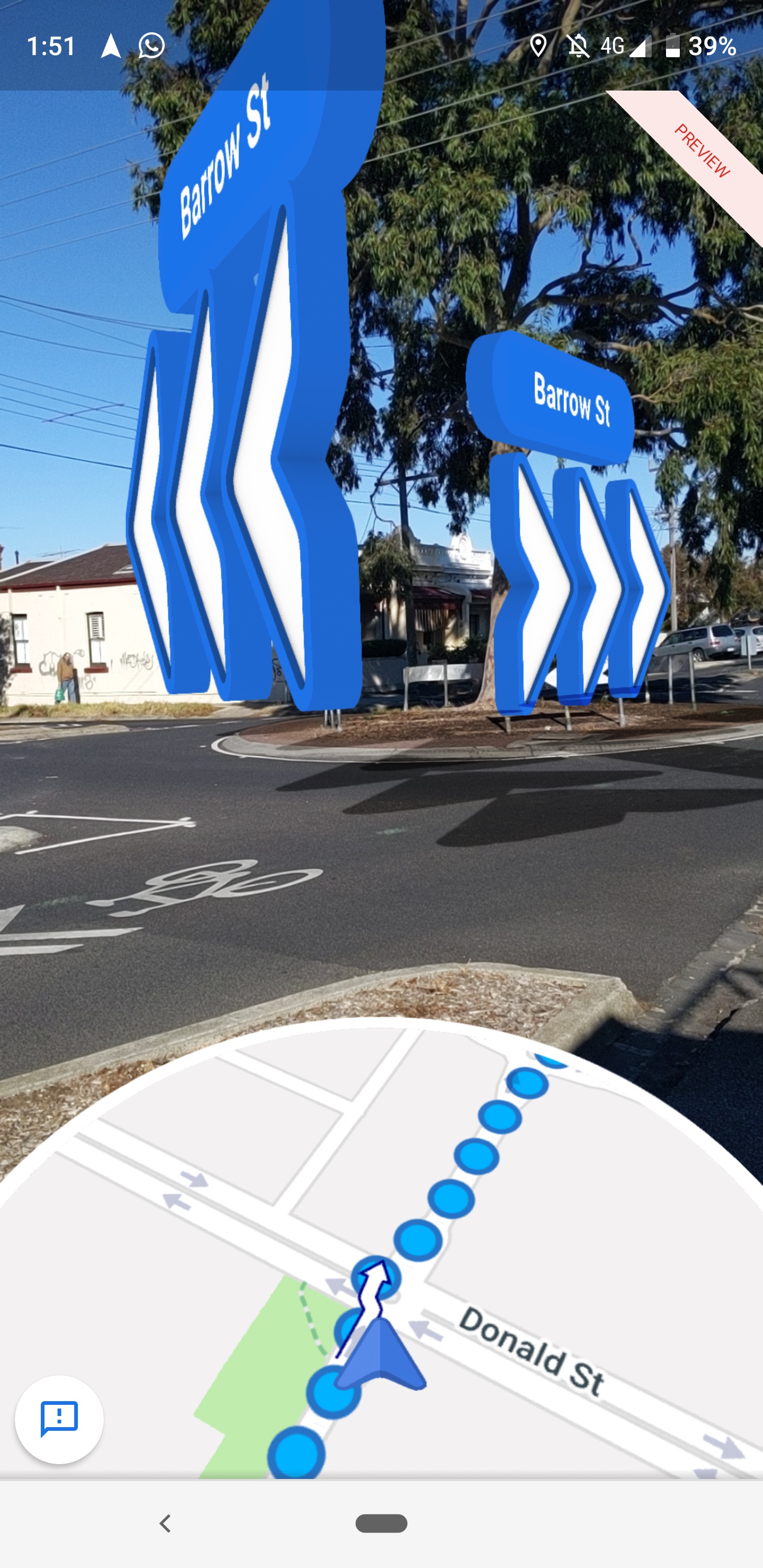
Despite this, I did encounter a few hiccups with the directions given. At roundabouts, the directions displayed are horribly confusing. If you’re meant to go straight through a crossing with a roundabout, the directions displayed take the roundabout into account (as if you’re in a car) and make it look like you go right then immediately left, which is a bad way to explain just going straight. It’s similar to how early GPS navigation systems in cars would get confused at a roundabout, and it’s a weird problem to have considering that the service is meant for walking, not driving.
Another problem, besides the small technical hiccups I experienced, is that I don’t personally see much applicable use of the feature in my day-to-day life. As someone who is quite savvy with directions and navigation, the usual Google Maps display works just fine. While Google have explained that AR directions could be hypothetically more consistent than GPS and phone sensor combinations, I’ve never had that many problems with the latter to make the former necessary.
The AR directions don’t really add anything that I don’t get from the normal navigation experience even though from a technical standpoint it’s incredibly cool. However personally, I can’t ever personally see myself launching the AR service to help me get to my destination. For those who are less savvy with maps and directions, the AR navigation might be a really good option.
I also think the experience was made slightly more redundant by living in Melbourne, a city with a clear grid structure. If I was travelling overseas or somewhere completely unknown, I can definitely see myself wanting to use the AR service to just quick get an idea of the general direction I should be heading. It would be especially useful for cities that are not on a clear grid and therefore are harder to navigate by map.
However, the biggest barrier in front of me using the service more often is that it’s currently all or nothing. You can’t just quickly hold your phone up to get your bearings via AR, and then lower your phone to go back to the map. You have to choose between AR directions or standard navigation. On my phone, the difference in start-up time between normal navigation and AR was just large enough to be annoying. I even had the Maps app crash a few times during use, or while trying to start up. This instability is frustrating when you consider that I was using Google’s flagship Pixel phone.
From a technical perspective, Google’s new AR navigation service is super cool and feels like something straight from the future. However, at the moment, the way in which it’s implemented means that I wouldn’t personally ever use it over normal walking navigation. With better, smoother implementation into the current navigation systems or integration into a glasses-based AR platform, the service could be really helpful, but for now it falls a bit short.